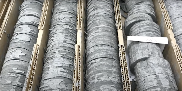
The U.S. Geological Survey awarded $4.8 million to 36 state geological surveys to enable them to preserve vital geologic and geophysical data and samples as part of the USGS National Geological and Geophysical Data Preservation Program (NGGDPP).
Source: U.S. Geological Survey
U.S. Department of the Interior
Photos: Public Domain
Of the $4.8 million to be awarded, $4.08 million comes from investments made by the Bipartisan Infrastructure Law. Every dollar awarded by the USGS is matched by state geological surveys, doubling the impact of the federal investment. This funding expands the capacity of the USGS NGGDPP to preserve physical samples (e.g., drill cores and geochemical samples) and earth-science assets, which are crucial for future scientific discovery, hazard mitigation, infrastructure development, critical mineral characterization, and climate resilience.

The U.S. relies heavily on critical minerals for uses ranging from smartphones and fertilizers to electric vehicles, defense and renewable energy. As supply chain vulnerabilities become a growing concern, interest in domestic resource potential has increased. Data and samples held by state geological surveys are key to identifying critical mineral potential, understanding groundwater resources and geologic hazards and supporting infrastructure projects.
Since 2007, the USGS NGGDPP has helped state geological surveys preserve data and samples through annual grants. This year’s funding includes more than $372,000 in appropriated funds from the USGS NGGDPP and an additional $328,000 from the USGS Earth Mapping Resources Initiative, on top of the $4.08 million from the Bipartisan Infrastructure Law. To support these preservation efforts, state geological surveys will contribute $4.8 million in matching funds.
The grants will preserve critical data by improving storage conditions for physical samples, advancing new technological methods to better characterize and use those samples, and driving the development of modern digital infrastructure that enhances public access to these important resources.

Summary of Successes: Why This Matters
- Doubling the Impact: Every dollar awarded is matched by state geological surveys, effectively doubling the federal investment and magnifying its impact.
- Advancing Science: The program supports the preservation of crucial geological data and physical samples, enabling future scientific discoveries related to critical minerals, groundwater resources and geologic hazards.
- Critical Mineral Resources Support: In support of the USGS Earth Mapping Resources Initiative, the program facilitates the submission of up to 300 samples per state for geochemical analysis of existing geological materials with critical mineral potential.
- Infrastructure Development: Improvement in physical storage conditions preserves the long-term availability of samples and cores for new research without costly reacquisition (AR, AZ, IN, MO, MT, NE, NM, OH, WV).
- Data Modernization: Updating data formats and improving digital access to these resources ensures that scientists, policymakers and the public can leverage this valuable information efficiently. An example is well log digitization and conversion to industry standard formats for web access (FL, ID, IN).
More information about the National Geological and Geophysical Data Preservation Program and its grants can be found at the NGGDPP website.
For more information about how the USGS is investing funding received from the Bipartisan Infrastructure Law can be found on the USGS BIL website.


