-and-
We will stay chilly, but Sunday will start a long duration warming trend through late week.
Source: National Weather Service
Images: Courtesy
FREEZE WARNING REMAINS IN EFFECT FROM MIDNIGHT TONIGHT TO 9 AM MDT SUNDAY
- WHAT…Sub-freezing temperatures as low as 22 expected.
- WHERE…Portions of south central and southwest New Mexico and southwest Texas.
- WHEN…From midnight tonight to 9 AM MDT Sunday.
- IMPACTS…Frost and freeze conditions could kill crops, other sensitive vegetation and possibly damage unprotected outdoor plumbing.
PRECAUTIONARY/PREPAREDNESS ACTIONS…
- Take steps now to protect tender plants from the cold.
- To prevent water pipes from freezing; wrap or drain or allow them to drip slowly.

Freeze Warning from midnight tonight to 9 AM MDT Sunday for East Central Tularosa Basin/Alamogordo-Lowlands of the Bootheel-Northern Dona Ana County-Sierra County Lakes-Southeast Tularosa Basin-Southern Dona Ana County/Mesilla Valley-Southwest Desert/Lower Gila River Valley-Southwest Desert/Mimbres Basin-West Central Tularosa Basin/White Sands.

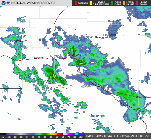
For tonight, the main upper storm system quickly exits to the east, but there is a hang-back lobe of energy that will slowly swing S and E across the region. That could be the reason we see some lingering lighter precipitation across the region through the overnight period. Tonight`s temperatures will be quite cooler, with most of the lowlands dropping into the 27-32F range. That means a late season freeze, past the average last freeze date for most areas. Thus we have also issued a Freeze Warning for all of the lowlands except the El Paso metro, and lower valley. In addition, and precipitation that does fall overnight will likely fall as snow, or at least a mix. However, there is not expected to be any accumulation die to light precipitation.
Sunday the last of the upper trough drops S and E of our region with dry northerly flow sweeping out the moisture, and clearing skies. We will stay chilly, but Sunday will start a long duration warming trend through late week.