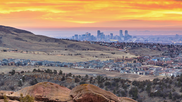
The following article details a demographic shift in America. In this shift, Americans are crossing county lines more often in their commute from rural counties to their employment centers in the cities. Doña Ana County has had this kind of rural/city arrangement for decades; however, this phenomenon is difficult to track given the size of the county.
For reference, Doña Ana County covers more area than the states of Delaware and Rhode Island–combined.
For decades, American families have been moving farther away from city centers in search of lifestyle changes, more space and other amenities. Suburbs have increasingly become employment centers, enabling workers to move farther out, even into rural areas, and still have a reasonable commute.
Source: U.S. Census Bureau
August 27, 2024 Author: Earlene K.P. Dowell
As a result, we’re seeing suburban-style subdivisions in otherwise rural areas; residents of small rural towns working in urban areas; and jobs in urban and suburban areas filled by workers living in predominantly agricultural areas.

“While this is not new, the trend has been a blurring of the line between rural and urban,” said Michael Ratcliffe, senior geographer in the U.S. Census Bureau’s Geography Division.
The increasing connectedness between people who live in rural areas but work in urban areas highlights an interesting dynamic: a melding of rural and urban economies.
Connected Economies
A 2023 Census Bureau Local Employment Dynamics (LED) Webinar explored “The Importance of Off-Farm Income to the Agricultural Economy.”
The webinar featured results of a study showing the rural and agricultural economy has evolved over the past half century to benefit connected and diverse communities.
Using the Longitudinal Employer-Household Dynamics (LEHD) Origin-Destination Employment Statistics (LODES) (FTP) data, the study (by University of Missouri Extension researchers Alan Spell, an assistant professor, and Justin Krohn, a research project analyst for the Center for Applied Research and Engagement Systems, highlighted increased interactions between workers and businesses across metropolitan and nonmetropolitan counties.
The map below shows change in the commuting patterns of rural area residents and growth in economic connectedness with urban areas from 2002 to 2018.

The University of Missouri Extension established the Center for Applied Research and Engagement Systems or CARES to develop maps and data visualization tools.
They used 2021 LODES data to show that the number of commuters working outside of the counties in which they lived increased by 15% or more in some areas.

Understanding this dynamic relationship is vital to strengthening the financial health of communities. But increased rural and urban economic interdependence can be hard to make out when geographic areas of different kinds of communities are not clearly defined or distinguishable.
“There are a lot of rural communities that are economically tied to larger cities, but they just disappear as they are being captured into metropolitan classifications,” Spell said.
This melding, however, is not reflected well in existing classifications and the way they tend to be used in analysis.
“This illustrates the need to move beyond urban/rural and metropolitan/nonmetropolitan definitions,’’ Ratcliffe said. “Instead, we need to develop and implement geographic area classifications that help highlight the social and economic relationships that, to some extent, have always existed.”
What Is “Rural?”
The Census Bureau defines urban areas as densely developed territory encompassing a variety of residential, commercial and nonresidential land uses.
Rural is basically any territory not in an urban area.
While the Census Bureau’s urban and rural classification divides areas into densely developed urban areas and less developed rural areas, it does not tell us about the social and economic interactions that occur between areas and across the urban-rural divide.
Many researchers have defined metropolitan as “urban” and nonmetropolitan as “rural.” Based on the Census Bureau’s definition, 55.7% of the nation’s rural population lives within metropolitan statistical areas.
A county could go from nonmetropolitan to metropolitan status for a variety of reasons: expansion of densely developed urban/suburban areas; more rural residents working in urban centers; urban area workers moving to rural communities; or a combination of these.
A change in status from nonmetropolitan to metropolitan should not necessarily be viewed as a change from rural to urban, but rather as an indicator that settlement patterns and economic interactions are changing.
A Need for New Classifications
Context matters and can change the economic dynamics of rural areas.
Changes in where people live and work point to the need for new kinds of classifications — ones that move away from describing communities simply as urban, rural, metropolitan or nonmetropolitan.
For example, a rural community within easy driving distance of an urban area has quick access to the variety of services, amenities and opportunities available in that urban center.
On the other hand, a small town farther away from larger urban centers might support services and retail not needed in small communities on the edge of a large urban area, allowing small businesses to compete against larger urban retailers. But more isolated rural areas may also not have enough people to sustain retail establishments, hospitals and other services.
Some different classifications of urban and rural already exist:
- The Department of Agriculture’s Economic Research Service defines Frontier and Remote (FAR) levels that identify ZIP codes where most of the population is at various distances from different sizes of Census Bureau urban areas. FAR Level 1 includes areas or ZIP codes where the majority of the population is 60 minutes or more from an urban area with 50,000 or more residents; FAR Level 4 identifies ZIP codes that are 15 minutes or more from an area with 2,500 or more people.
- The National Center for Education Statistics’ locale codes [PDF <1.0 MB] identify four basic area types: city, suburban, town and rural. The city and suburban categories can be distinguished further by population size. The town and rural categories can be subdivided based on proximity to or distance from an urban area.
- At an international level, the United Nations adopted the Degree of Urbanization classification for use in cross-country comparisons. It classifies territory ranging from urban center, suburban, urban cluster, rural villages and low-density rural territory.
“Delineating a line between rural and urban America has always been problematic, and the complexity of today’s settlement system now makes futile any search for a one-size-fits-all solution,” Ratcliffe and U.S. Department of Agriculture Economic Research Service geographer John Cromartie wrote in Rural Definitions and Measures Tools. “A better strategy is to recognize that urban and rural are multi-dimensional concepts incorporating size, density, distance and other perspectives.”
Earlene K.P. Dowell is a supervisory program analyst in the Census Bureau’s Economic Management Division.


