
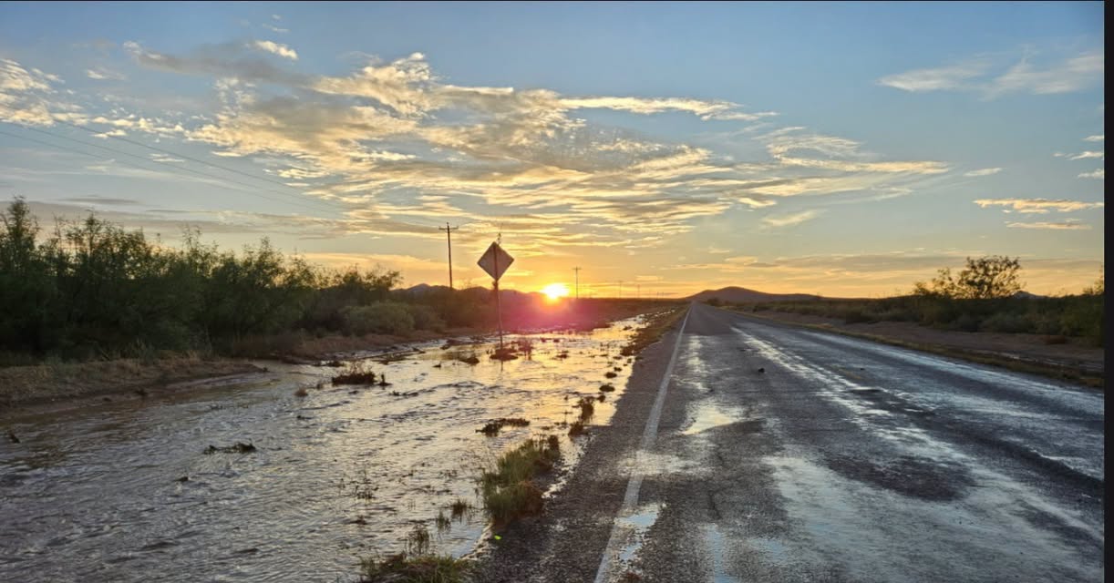

The New Mexico Department of Transportation warned Thursday that flooding was affecting roads across the state, particularly in northern and western New Mexico.
Source: NMDOT (via Facebook), NASA, USDA Natural Resources Conservation Service (NRCS)
Images: Courtesy
New Mexico is closing out the final days of summer with flooding concerns across much of the state, even as a sprawling heat dome keeps temperatures unusually high across portions of the central and southern United States.
The New Mexico Department of Transportation warned Thursday that flooding was affecting roads across the state, particularly in northern and western New Mexico. Photographs released by the department showed water covering portions of NM 9 west of Animas in Hidalgo County.


NMDOT cautioned that roads may be covered by water or remain wet and slick, with low-lying areas particularly vulnerable to flash flooding.
Southern New Mexico remains part of the concern. The National Weather Service placed portions of Doña Ana, Sierra, Luna and eastern Grant counties, along with the Sacramento Mountains, under a Flood Watch from noon Thursday through 6 a.m. Friday.
According to the Weather Service, a broad area of south-central New Mexico received 1 to 2 inches of rain during the previous 24 hours. With soils already holding substantial moisture, additional rainfall could quickly produce runoff, particularly around arroyos and low-water crossings.
The wet weather stands in contrast to conditions farther east.

A NASA Earth Observatory analysis published Thursday showed a heat dome covering a broad portion of the south-central United States earlier in the week. On Sept. 15, more than 41 million people were under some form of National Weather Service extreme heat alert, with record daily highs recorded in Dallas, Memphis and Nashville.
NASA described the heat dome as an area of upper-atmospheric high pressure that pushes warm air toward the surface while suppressing clouds and precipitation. The episode followed the warmest June-through-August period recorded in the contiguous United States in 132 years of records.
For New Mexico, meanwhile, the immediate outlook remains wet.

The USDA Natural Resources Conservation Service’s weekly weather report said an unusually wet pattern across the Southwest is expected to shift east during the weekend, although another 1 to 2 inches of rain could produce flash flooding in some areas, particularly around burn scars.
Looking farther ahead, the report’s Sept. 22–26 outlook favors above-normal temperatures across nearly all of the continental United States while also favoring above-normal precipitation in the Southwest.
Beyond that short-term forecast, another climate pattern is developing in the Pacific.
NOAA says El Niño is strengthening, with a greater than 90% chance of becoming a very strong event during the fall and winter of 2026-27. The agency’s latest seasonal outlook favors wetter-than-normal conditions across much of the southern United States, including the Four Corners region, as the El Niño pattern develops.
Those seasonal forecasts do not mean this week’s storms or flooding were caused by El Niño, nor do they predict rain on any particular day. They do, however, provide a longer-range backdrop as New Mexico moves from an unusually wet end to summer toward fall and winter.
For now, New Mexico remains in an unusual late-summer combination: temperatures are expected to remain warm, but the immediate concern is water.
Drivers can check current New Mexico road conditions and closures through NMDOT’s NM Roads system.
You must be logged in to post a comment.